
TREES AND TRAILS ON MUSANGANO
Feel like going for a walk or hike?

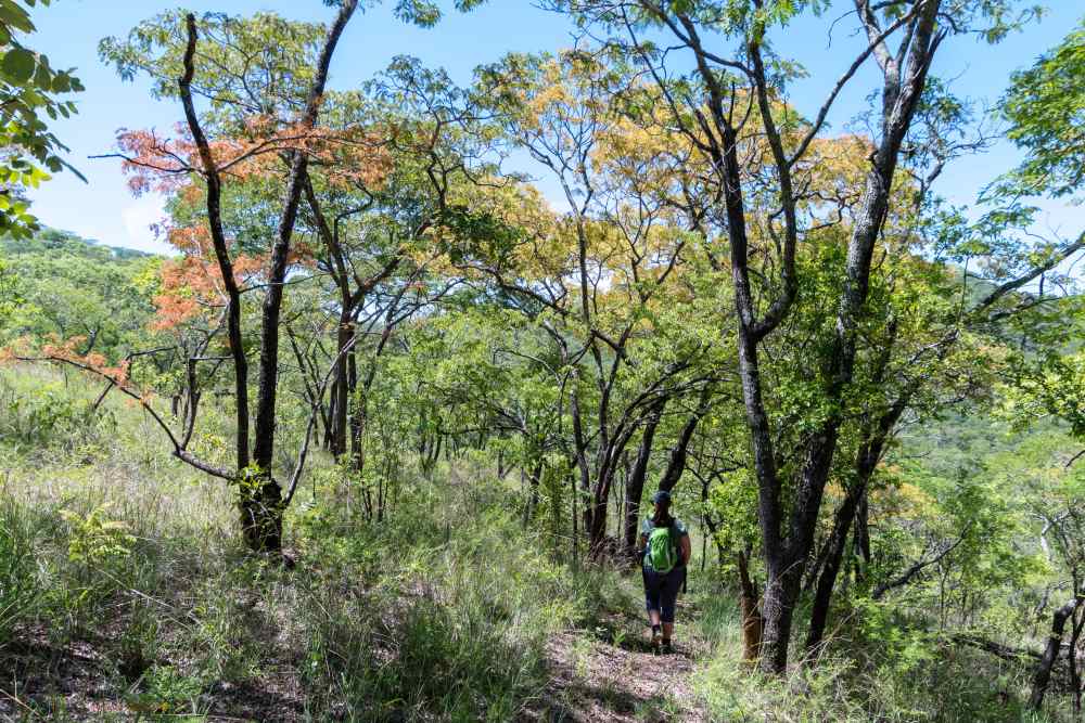
The area around Musangano consists predominantly of miombo woodlands, where the tree species msasa and munhondo are common. Our accommodation units are named in the local Shona language after these typical tree species.
Between September and November the msasa trees produce new leaves, resulting in a vibrant display of colours ranging from deep reds through to orange and golden yellow. These tree species are unusual in that the green pigment found in trees (chlorophyll) is produced only after the leaves have fully developed.
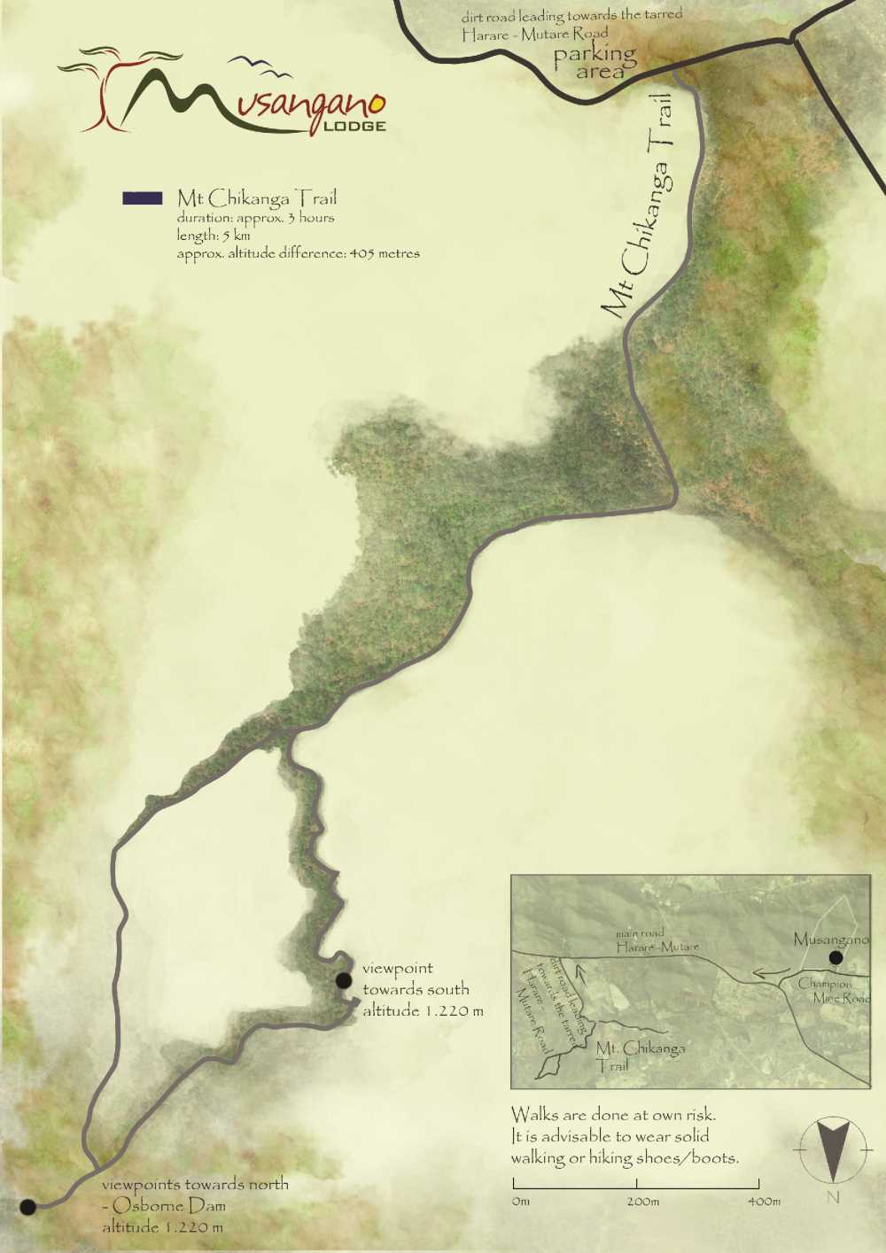
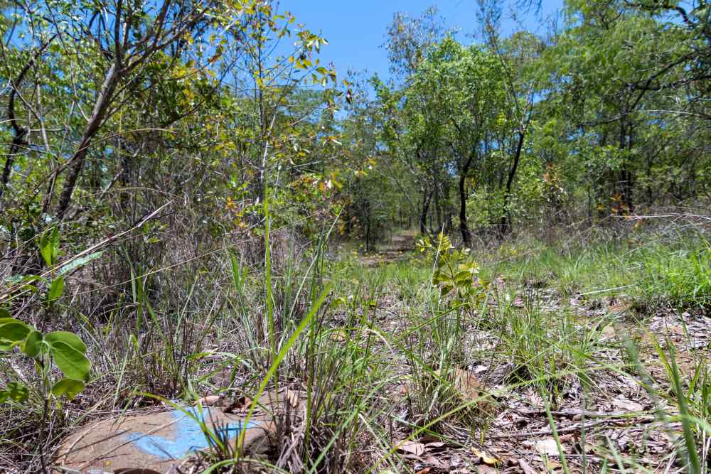
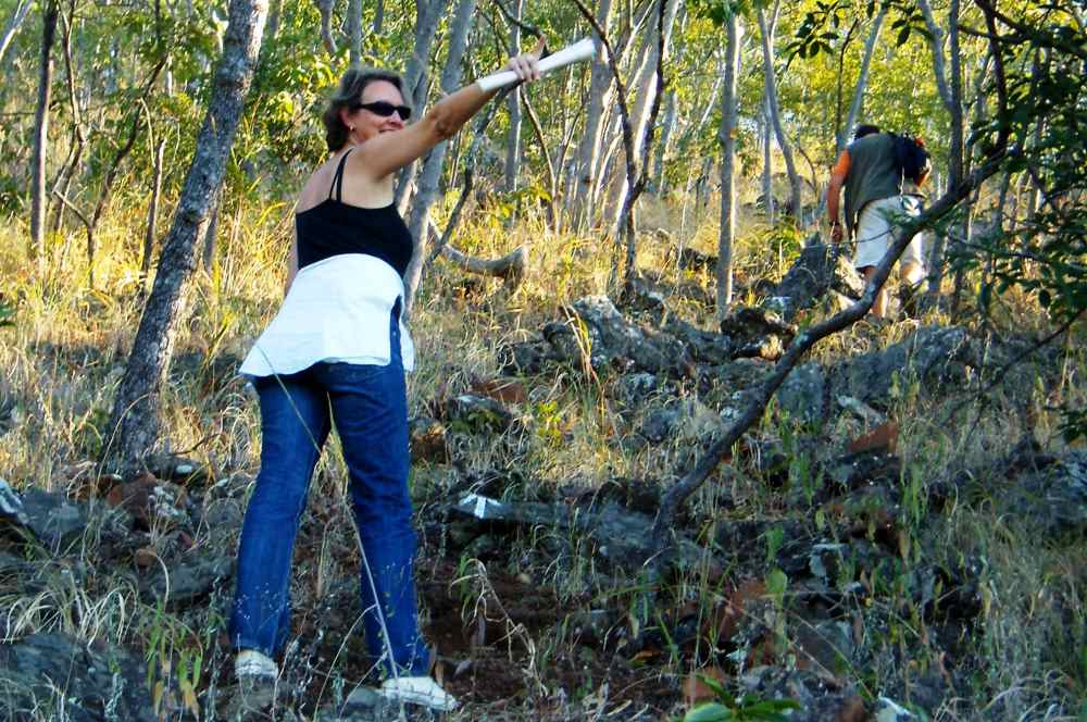
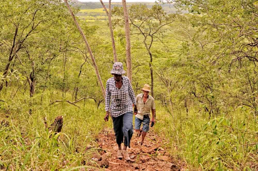
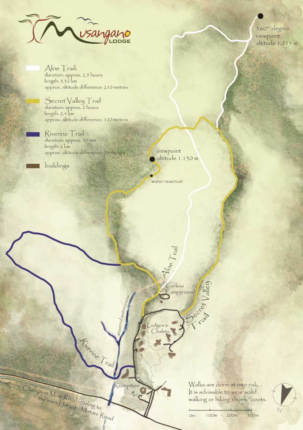
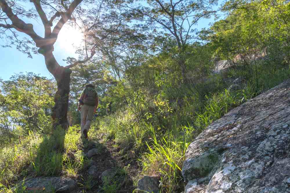
There are three walking trails on the Musangano Lodge property, all of which start from the road leading past the chalets. Each trail is colour-coded with painted metal squares found along the route to guide you. While the Riverine Trail is in flat country, the other two trails have steep rocky sections – good walking shoes are highly recommended! A fourth trail takes you up Mount Chikanga, which is approximately 8 km from Musangano Lodge. This is the only trail where a guide has to be booked in advance. Please inquire at reception for further information and fees.
All trails on the property cross the vlei, which is a flat grassy area, where the lodge´s borehole is located. Vleis are geological features characterized by rich black clay soil that is very water absorbent and moist. In the past, people grew cotton in the vlei, but today it has reverted back to its natural state.
Along all the trails, one can see how humans shape the environment once they start utilizing it. At first sight the vegetation appears natural, yet at a closer look it becomes obvious that many tree trunks are small in diameter. This is a sign that the woodlands are secondary, meaning, the area was most likely deforested at some time. Even though the measures to replant trees can only show results in the next generation, Musangano supports endemic tree species by planting fig, mahogany, and other indigenous tree species.
Walks around Musangano Lodge
Musangano Lodge has established three walking trails on its property. Explore these trails as you please but always remember to wear stable and closed shoes, after all, this is the African bush! Along all three trails, markings and arrows help you find your way. However, there is a map available at reception for further orientation.
The Riverine Trail
The Riverine Trail is the shortest and least demanding of the walking trails, ideal for an afternoon stroll of less than an hour. This trail leads you through typical miombo woodland, crossing several dry stream beds, which may have flowing water during the rainy season.
The Secret Valley Trail
The Secret Valley Trail, marked by yellow squares, follows a rocky stream bed for a distance before heading up the hill on which the lodge’s water tank is situated. Mountain acacia trees dominate, and the path elevates into steep sections at times. From the top of the hill, with a panoramic view, the trail heads south along a ridge before descending into another valley and meandering along a stream bed. The trail crosses the “up” section of the Aloe Trail, and finally joins with the “down” section of the Aloe Trail leading back to the lodge. The trail takes between 2 to 3 hours.
The Aloe Trail
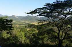
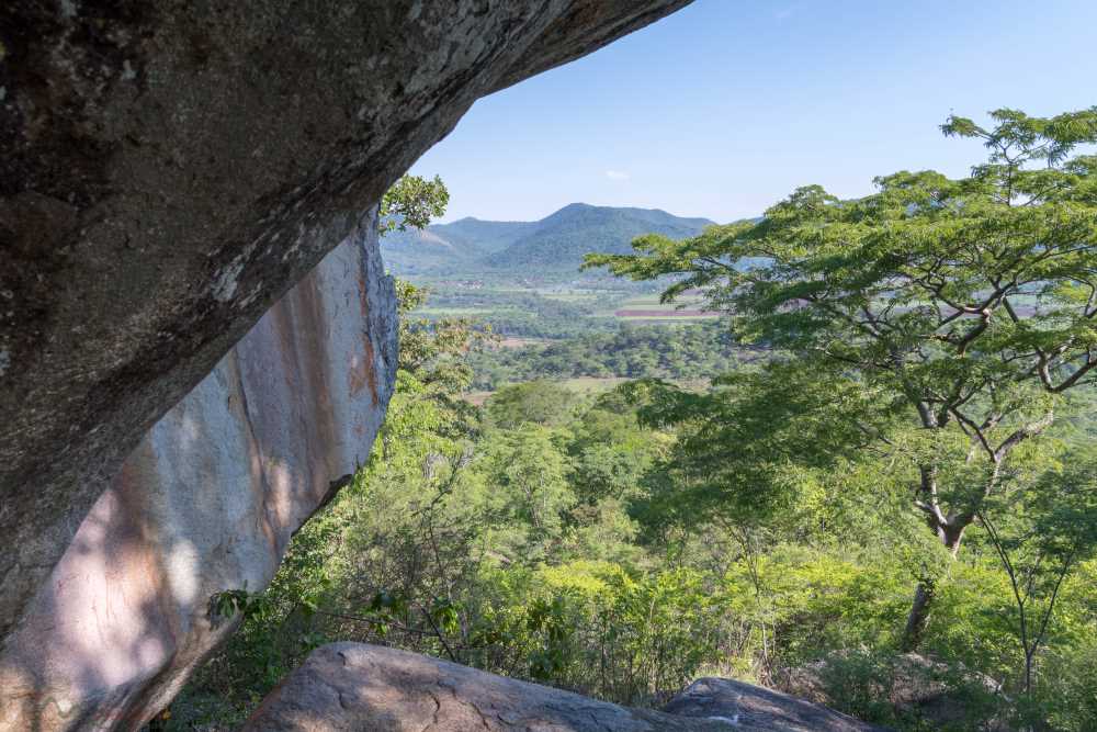
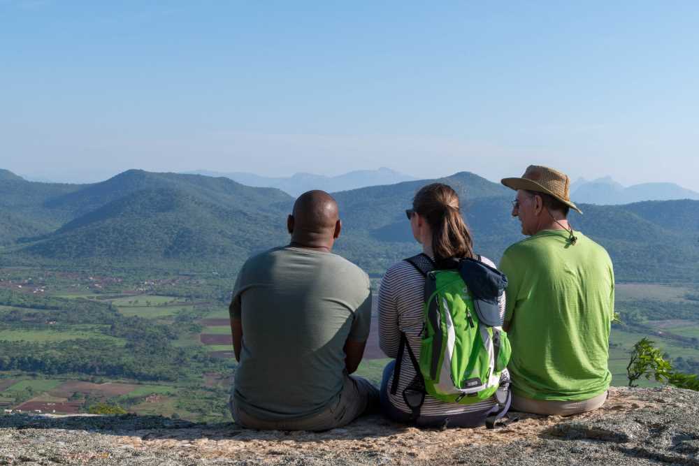
The Aloe Trail is a premier walking trail at Musangano, leading to the summit of the ridge and to the south, with a spectacular view of the surrounding countryside. The trail starts off in a typical miombo woodland, but, as it ascends, the mountain acacia is more common. About halfway up the trail is a colony of aloes, hence the name of the trail. Nearing the summit the slope is quite steep, but many large rocks provide convenient resting places. At the top of the hill is a survey beacon where the altitude is 1.235 metres. The 360-degree view is breath-taking, and on a clear day, you can see Mutare towards the east and Odzi in the west. Looking north fields indicate the intensive agricultural activities of the area, while to the south, the Grand Reef Aerodrome Airstrip lies adjacent to a resettled government property of Mutare, known as the Himalaya.
From the summit the trail descends on a different route and returns to the lodge via the road leading up to the hilltop lodges. The total distance is about 4 kms and, depending upon fitness, the trail will take from 2 to 3 hours. The sunset from the summit along with a sundowner is spectacular but start your return journey early to guarantee enough time to reach the lodge before nightfall.
Image Gallery
Map of Trails
The Mount Chikanga Trail
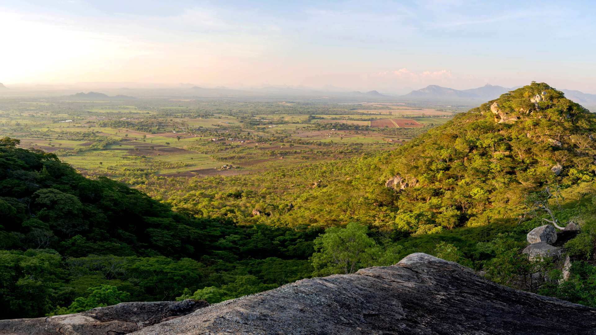
Allow about 3 hours for this varied and interesting trail which involves a steady and fairly demanding climb through a rocky woodland environment. The reward is a superb view of the surrounding countryside and the distant Osborne National Park including Osborne dam. A further bonus on this trail are ancient walls and an iron ore smelting site. On the summit sits a clay pot used in traditional ancient rainmaking ceremonies by the locals.
The Mount ChikangaTrail
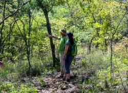
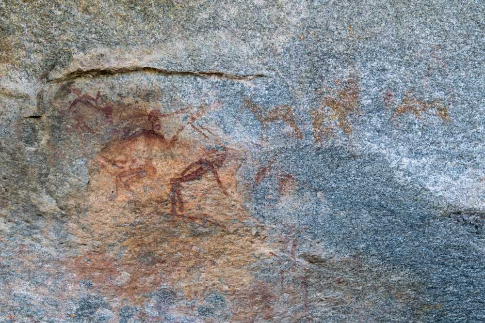
Your guide transfers you to the starting point of the hike along Chikanga Road, a rough track linking the main Harare – Mutare road to Grange road. First, the trail leads through communal farm and scrubland to a village populated by subsistence and resettled farmers. Shortly after this, the trail bears left, and you begin to climb upwards. Having navigated through barbed wire fence, you follow the arrows painted on the rocks. Rock paintings can be found in two separate caves along the trail but are rather indistinct, damaged by centuries of water flowing over them. However, local animals and scenes of daily village life can still be identified. Luckily the paintings are in red, which is not as sensitive to natural processes affecting rock paintings than the colour white. The rock paintings illustrate man, the hunter, with his equipment and woman, the gatherer, while also reflecting her reproductive role in society.
The ascent through the ecosystem requires constant vigilance as one follows the track through mountain acacias, rocks, and vegetation. After a 60-to-90-minute hike through the landscape, you finally reach the ridge. From here you make your way to a bare flat rock to sit, recover and indulge in some refreshments. On your return down, you descend briefly, traversing the steep-sided south face of the hill with care before climbing to the next high point. Just above, grain bins are located, which are used to store food such as maize for times of drought. The clay pot for traditional rain-making rituals also sits nearby if of interest.
From this vantage point one can scan the Odzi farms as far as Osborne dam. The dam was built in the late 1990s to supply water to farms and increase the flow of the Odzi and Save rivers to supply water to the sugar estates in the Chiredzi region. The decline from the summit proceeds around the eastern end of the ridge before crossing back across the south face while passing through more rocky passages, which have to be treated with care. Eventually, the path becomes less steep, and the farmland is reached again. This is a very enjoyable final stage of the hike, when the sun drops, the birds escort you with their evening chorus, and dusk arrives.
Image Gallery

Map of Trail